Surveying, Data Acquisition
Data economy or development projects, data is the foundation of it all. Datech Geospatial is committed to providing solutions for high accuracy, reliable, fast and easily usable geospatial data. Ensure efficient planning and functioning with our range of data acquisition and surveying services designed to meet diverse requirements across a range of sectors.
Drone Surveying
- Drone-based data capture with RGB / LiDAR/ multispectral sensors for geo-tagged data
- Orthomosaic maps
- 3D point clouds
- Digital surface models
- Digital terrain models
- Contour lines
- 3D textured mesh
LIDAR mapping
- UAV LiDAR mapping
- Vehicle mount LiDAR mapping
- Handheld mapping
- 3D point clouds
- Planimetric mapping
- Contour generation
- Digital surface model (DSM)
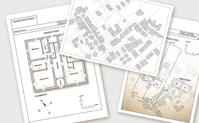
Topographic and cadastral surveys
- Utility /telecom surveys
- Urban planning / property surveys
- Engineering surveys
- Household surveys
- Field updating of maps
- Wetland delineation
- Boundary surveys
- Floor Plan
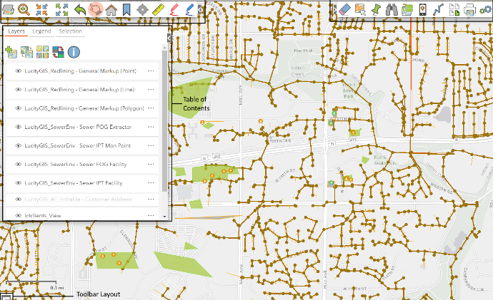
Asset mapping
- Custom maps of assets
- Building and pipeline mapping
- Residential and commercial properties
- Roadway and drainage project staking
- Utilities mapping
- Facilities mapping